New FOUND Land, At Last
Dispatch VIII
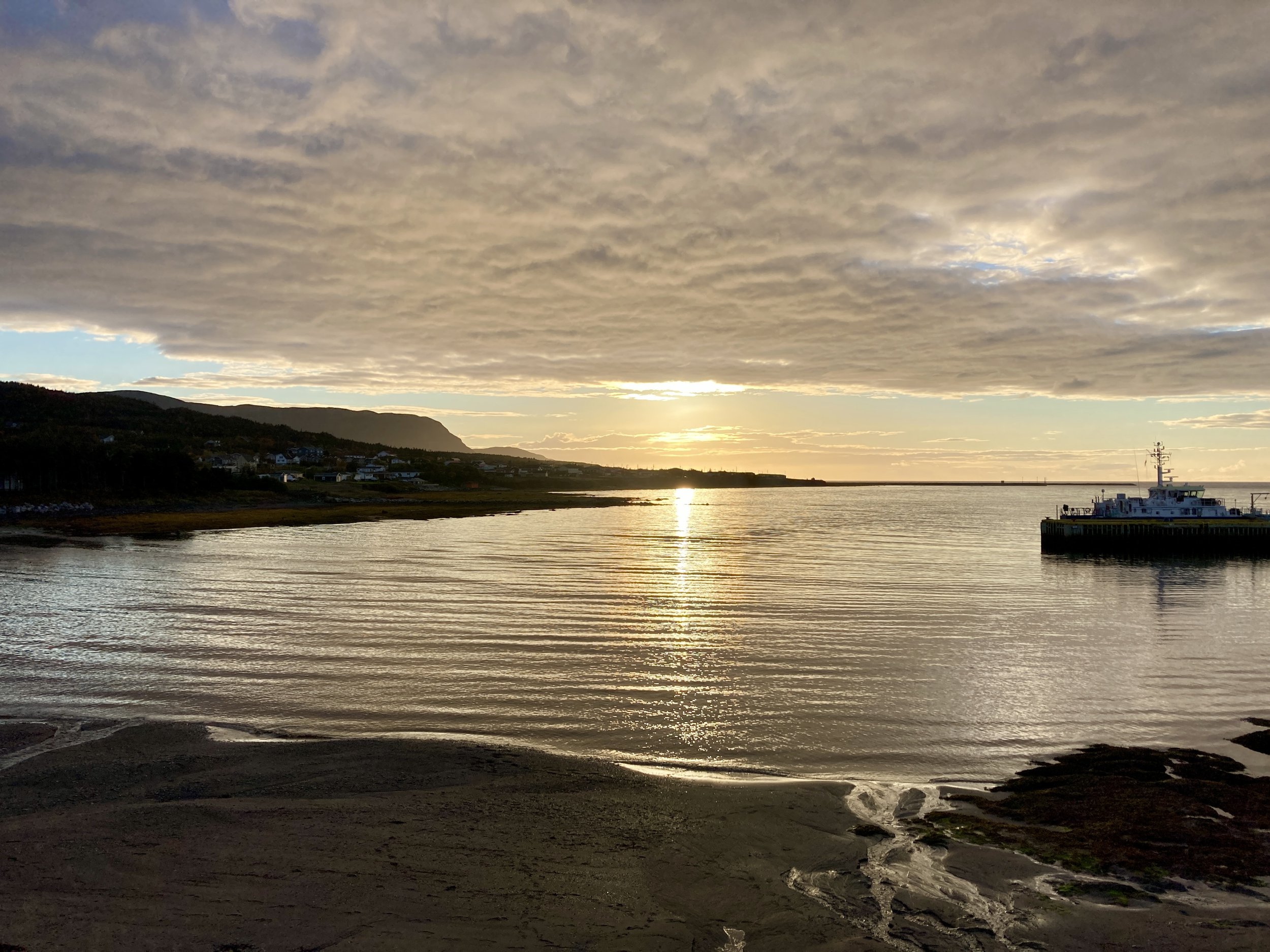
Ferrying across John Cabot Straits to Newfoundland
In the early 1960s two very persistent Norse archaeologists discovered something remarkable. One thousand years ago (almost to the month according to National Geographic), Lief Ericsson, and a contingent of Viking sailors arrived in North American five centuries before Columbus stumbled across the Atlantic Ocean and into the Bahamas. Astounding news to traditional archeologists everywhere, and all the rest of us who had grown up thinking that it was Columbus who had “discovered” America.

Sculpture of Viking explorers who made their way to North America 500 years before Columbus. (Photo by Chip Walter)
They landed at the northern tip of a place known these days as Newfoundland. That was where Cyndy and I were headed as we passed a November evening at Tim Horton’s fine restaurant (a Canadian cross between McDonalds and Starbucks) along the lip of North Sydney harbor, Nova Scotia. But first we had to board the ferry that would take us that evening across the untamed waters of John Cabot Straits to the southern end of Newfoundland and the town of Port aux Basques, the only ferry crossing available in November. From there we would head north up Newfoundland's Great Peninsula.
We had hoped to land a berth on the ship (the Blue Puttee) and get a good night’s sleep for our 6 am arrival, but harsh weather had cancelled the big ferry twice in the past two days. Not unusual in the unpredictable North Atlantic, but since previous passengers had first dibs on any of the available berths the evening we wanted to travel, we were relegated to the cheap seats — decks seven and eight. That was fine with us. We were eager to get to the wilds of New FOUND Land, and we had already booked places to stay on the island. Changing them would set dominoes in place we didn’t want to topple. Besides, though all the overnight berths were taken, there was plenty of room throughout the ship for coach passengers (thank you COVID), and a canteen handy for snacks and coffee, wine and beer, just in case.

(Photo by Chip Walter)
At 10 pm, we wrapped our Tim Horton food containers and drove the 1/2 mile onto the rain-slick harbor to line up with the 100 or so other drivers and their vehicles, everything from 18 wheelers to motorcycles. The process went smooth as pie, and, after proving we weren’t contagious, we rattled onto the big ship, grabbed our day packs (read toiletries) and hiked up to deck seven and some quiet seats with a perfect view of the black and rolling ocean in front of us. At 12 am sharp, the ferry’s enormous engines thundered beneath us and the ship’s bow plowed north. Soon we were settled and well asleep.

Arrival at Port aux Basque. The sun was just a dream. (Photo by Chip Walter)
Driving the Viking Trail
When we arrived 6 hours later, the sun was a dim dream on the horizon. It had been raining hard when we came into port, but by the time we emerged from the bowels of the ship and found the road that would take us to the Viking settlement, the rain had stopped. Ghostly clouds scuttled across a blue-slate sky as we passed a sign that read Table Mountains, and headed up a mesa above massive granite cliffs. The mountains’ foothills were really drummonds, enormous, rocky remains of glaciers that had begun retreating 10,000 years ago. Among the hunched, larger unforgiving mountains, pine trees hung like green pin cushions, wind-bent by the long, savage winters in which they had grown.
As we came over the first mountains, a broad valley opened up and we saw before us an immense cloud perhaps 20 miles from one end to the other. It simply sat unmoving, curled against the mountain’s shoulder as if alive, perfectly happy not to move. And it didn’t, at least not as long as we could see it before passing to still higher ground.
We passed nothing as we drove, except the wild terrain, and peeled off onto one of Newfoundland’s few big highways—this one known as the Viking Trail. No buildings or homes, no farms or ranches or factories. People are scarce in Newfoundland, but the earth — in every possible configuration — is not.

(Photo by Chip Walter)
We had driven a sleep-deprived hour or so before we found a lone convenience store on the left of the highway. Food? No. But there was sustenance, a young woman working at the register assured us, “There’s an Irving’s just up the road, and next to it is a diner.” (We would become good friends with Irvings everywhere in Newfoundland because that was about the only place gasoline could be had.) “It’s not far,” she said, “just ahead, about an hour.”
An hour? Clearly the dimensions of space and time among Newfoundlanders was different than ours. Blearily, we drove on, and when we found the diner, we booked into it as if it were a Four Seasons Sunday brunch. The building was simple, a flat roofed rectangle, clapboard-sided with a neon sign in one window that beckoned us with the words OPEN … OPEN ... OPEN.

Sustenance! (Photo by Chip Walter)
We entered to the smells of coffee, eggs, bacon and a tiny, elderly waitress as energetic as a Christmas elf with an Irish lilt and phraseology of a long-haul truck-driver. In no time, she placed the first really traditional breakfast we had had in weeks in front of us: biscuits, gravy, eggs, much coffee, sausage and bacon and jam. Bring it on!
Fortified, we headed back onto the Viking Trail, which had by now slimmed down to two lanes with regular signs suggesting we be careful not to hit the moose that cross the road. More Moose had died in 2020 than 2021 (I thought I had noted the exact numbers somewhere but can’t find them , but they were wrecking the moose, cars and people at the rate of 20 to 25 a year). Either way, we wanted to make certain we didn’t increase the number of deceased Alces alces and total our rented car with them.
The reason there were so many moose murders was because the numbers of the animals had been increasing over the past 100 years when traders first introduced them from Nova Scotia to provide meat to the locals. In this they succeeded, but too often in the form of roadkill. As of 2021 nearly 5000 moose were roaming Newfoundland’s largest national park, exactly where we were headed. Moose can weigh in at more than a half ton, stand 6 feet at the shoulders, and each one of them eats approximately 40 pounds of vegetation each day. Rough on the natural environment. (The Canadian government has been slowly relocating them.) We kept our eyes peeled, though apparently the most lethal times they might make a sudden appearance was at dawn and dusk.
Gros Morne National Park
We wouldn’t make the 400 plus miles to the Viking settlement that day, and we didn’t try. The goal that day was to make it to the tiny town of Rocky Harbor before we fell asleep. We drove on into a gray sky. As we approached the village, we entered a gorge and had to stop the car. To our left, a stunning body of water suddenly appeared, and steep, imposing mountains pressed and jutted above us, dwarfing our car and making the Viking Trail look like little more than a thin string of yarn. We had arrived at Gros Morne National Park, our third World Heritage Site.

Stopped in our tracks. (Photo by Chip Walter)
We didn’t know it, but Gros Morne, the mountain that gave the Park its name, was Newfoundland’s second highest. It sat beyond, rising, round, hunched and granite-bald above us, but in the rapidly descending darkness, we didn't even know it existed until the next morning.
Rocky Harbor was tiny, and by late October, pretty desolate. We had found a little motel, and once settled, snatched a bit of sleep and then found one open restaurant for dinner. It sat, ramshackle along the water we had seen when we drove into the gorge. A tiny, boney woman who went by the name of Neila (Kneel-Lah) was our server. (“Alien backwards,” her fellow waitress noted.) The sun was just setting and I asked her what body of water we were looking at. We had rarely seen such a beautiful sunset.
“Thas the Atlantic Ocean!” (Photo by Chip Walter)
‘Wah?” Said Neila. She was turning her head and squinting as if I had asked her to list the Periodic Table. I repeated my question. “Well,” she said in her Newfoundland lilt, “Thas tha Atlantic Ocean!”
Hornswoggled by another estuary! We all had a good laugh about that, and a nice chat about the best places to see all around: Gros Morne, of course; another little town beyond the mountains called Norris Point, and the lighthouse at Port aux Choix farther north. If we were lucky, we might see caribou there …
The more deeply we penetrated Newfoundland’s Great Peninsula, the more unique the language and accents became until sometimes we had trouble recognizing them as English. The words came out fast, crumpled together in our foreign ear. Neila’s was almost a Gaelic brogue, as in (when discussing money), “That’ll be ten-tirt-eh. (Ten dollars, thirty cents.)” Or “Woud ya be wantin’ sum tay-tahrs (potatoes) wid ‘at?” Or, “have a bit more coffeh, sore? (Sir.)” I loved the sayings and local words too. “Stun,” for example which means strong, as in “Stun as my arse” — the description of some strong, dark chocolate I had bought. Apparently the now famous, “Not the sharpest tool in the drawer,” originated in Newfoundland.

The tiny village of Norris Point. (Photo by Chip Walter)

Gros Morne - Odin-like. (Photo by Chip Walter)
The next day — the first truly brisk morning we had awakened to — Cyn and I made a quick visit to Norris Point, and then, from the long ridge above it, we turned our mortal gaze in the opposite direction to the immensity of Gros Morne. It’s hard to explain exactly what Gros Morne means, though when you hear the words, they somehow seem perfect. The best way to translate the french is “big, isolated, gloomy mountain.” It broods above the other mountains along the coast, Odin-like, silently looking down on the landmasses that first crashed to create it one billion years ago, the time when the earliest geological descendants of the Appalachian Range formed.
We wondered what secrets lay in the mind of that great mountain, but it gave us only silence, and so we moved ever north.
We took Neila’s advice and turned off the Viking Trail to Port aux Choix (a choice port) in search of caribou, but found nothing but fog, wind and trees bowed and contorted by a life of damp, howling winds, before we finally made it past the little village to its famous lighthouse along the wild Atlantic coast.

Bowed but not broken -- the trees of Port aux Choix fight the unrelenting wind. (Photo by Chip Walter)

The famous lighthouse at Port of Choix. Wind and fog and crashing seas, but no caribou. (Photo by Chip Walter)
Just a From there we sped north and passed the remainder of the afternoon in descending darkness and pelting rain until at last we reached the very tip of Newfoundland and the town of St. Anthony. The next morning, we would at last set out for the Viking Settlement that had caught my attention and wonder when I first read about it as a boy. What could be more enthralling than a Viking adventure from 1000 years ago!
Cyn and I will leave you with a rousing song to send you along with us on our Norse journey.
https://youtu.be/LkOUh6kR89k
Meanwhile ...
Crack on!
C- Squared
____________________________________
This is a series about Cyndy and Chip’s Vagabond Adventure - our journey to explore all seven continents, all seven seas and 100+ countries by land and sea, but never by jet. COVID has forced us to begin the North America, not a bad start, but soon we'll be heading overseas. What will the world be like following a global pandemic? What people will we meet? What cultures, places, languages and music will broaden us? Are we being pulled apart or are we coming together? We’ll find out. Come along with us on our #vagabondadventure. And tell us what you know and what you have learned in the parts of the world where you live.